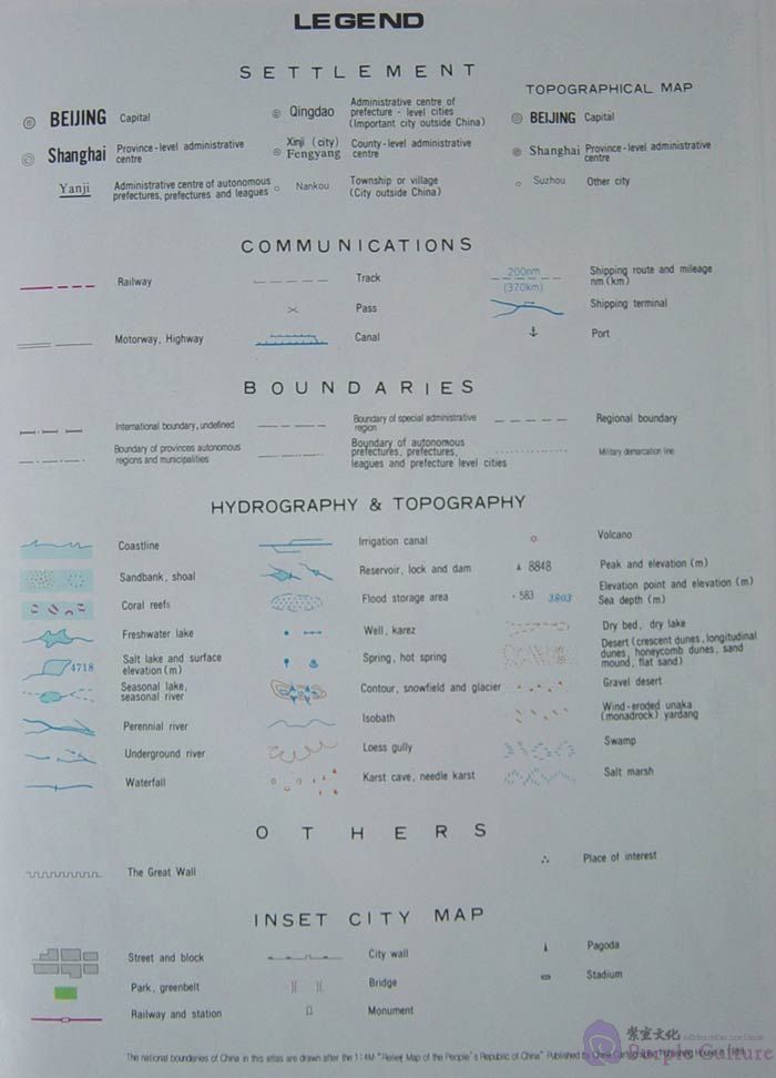
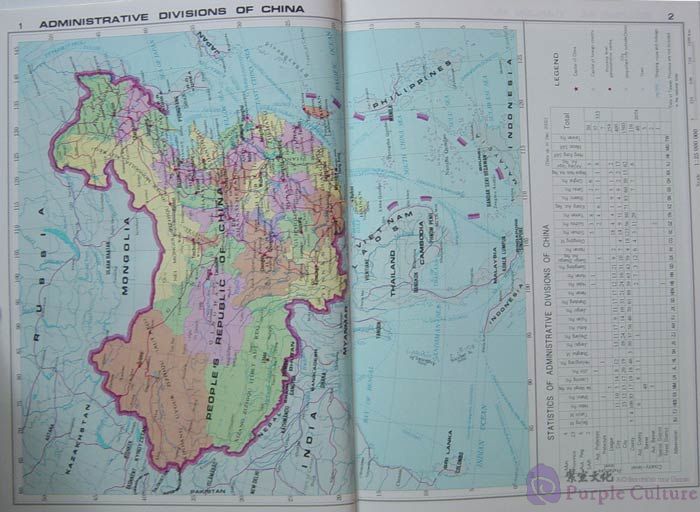
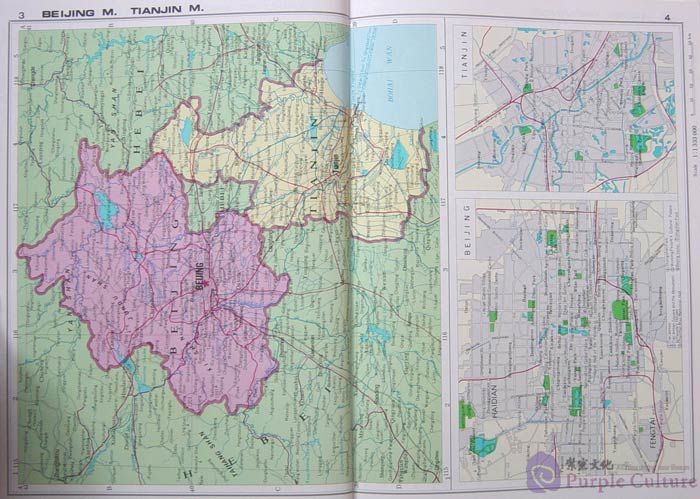
Detailed and up-to-date,the Atlas of China are organized by maps of administrative divisions and topography, supplemented with and index to place names. In the first category, two regions of strategic importance and great economic value are mapped, in addition to all the provinces, autonomous regions and municipalities directly under the Central Government, which are the first level of administrative divisions under the state. The two geographical rather than administrative regions are Shanghai-Nanjing-Hangzhou Region and Chengdu-Chongqing Region. The topographic maps produce a clear picture of China’s landform.
A comprehensive atlas of China, this volume will be of great value to universities, libraries, research institutes, and individuals who are interested in this country.
图集的注记和文字说明采用英文,地图由政区地图和地形图组成。政区地图为分省图,并附有部分城市简图。地形图为区域图,采用等高线分层设色,图面清晰美观。书后有详细的索引,方便检索与查找。本图集适合大学、研究院、图书馆以及有兴趣的人士使用。

 Advanced Comprehensive Course I")
 Intermediate Speaking Course II")

 12th Edition")
 1:6000000")

现代汉语词典(第6版)")
